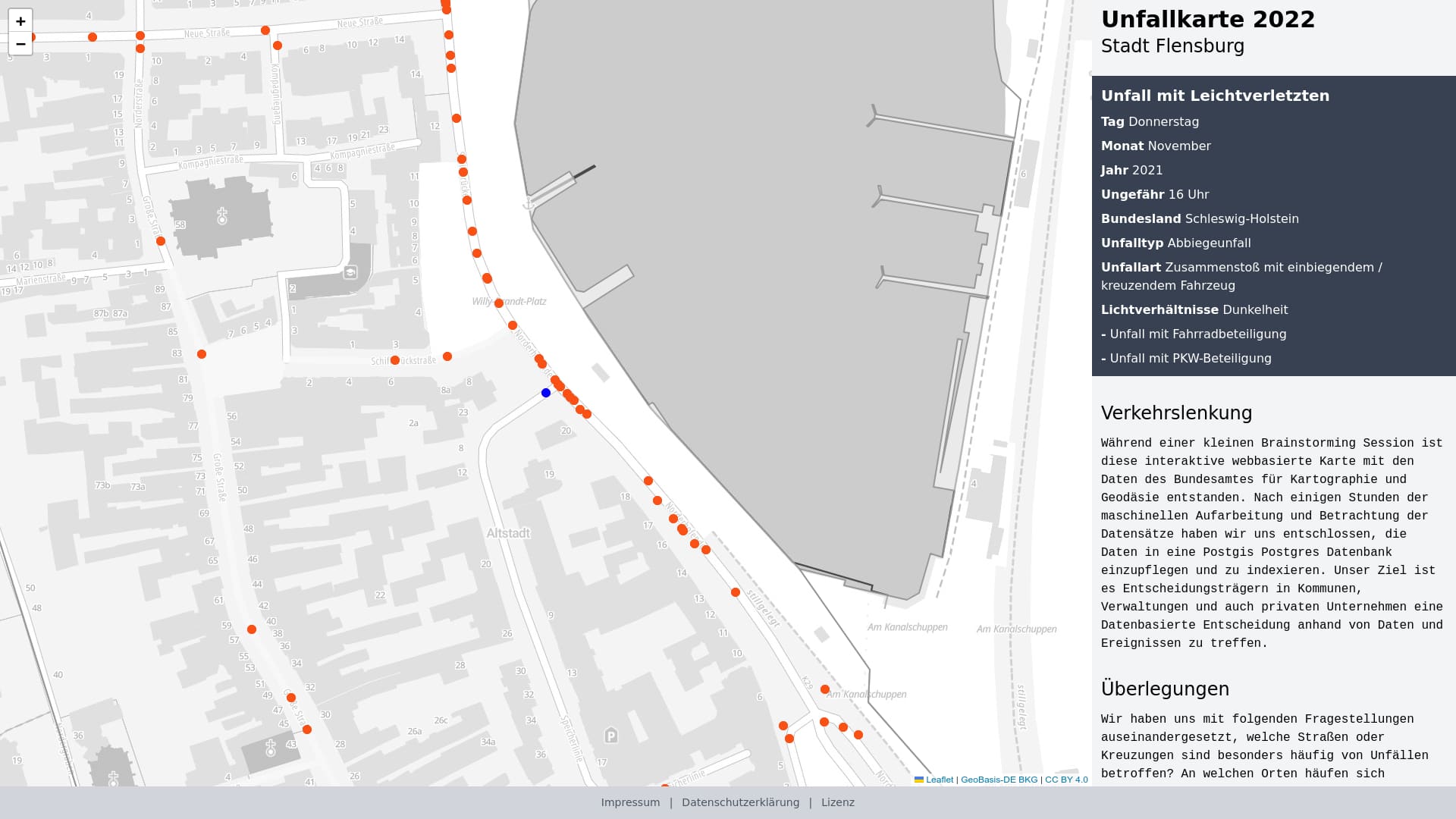
Map mit Verkehrsunfällen mit Personenschaden im Zeitraum 2016 - 2023 mit Daten der Statistischen Ämter des Bundes und der Länder sowie des BKG aktualisiert. Unfälle, bei denen nur Sachschaden entsteht, werden nicht dargestellt.
Install system dependencies and packages
sudo apt update
sudo apt install wget
sudo apt install git git-lfs
sudo apt install python3 python3-pip python3-venv
sudo apt install postgresql-16 postgresql-postgis gdal-bin
git clone https://github.com/oklabflensburg/open-accident-map.git
cd open-accident-map
To insert the accident meta data run this sql script
psql -U oklab -h localhost -d oklab -p 5432 < data/de_accident_meta_schema.sqlSince November 2024, new table names and structures are used.
wget https://www.opengeodata.nrw.de/produkte/transport_verkehr/unfallatlas/Unfallorte2023_EPSG25832_Shape.zip
unzip Unfallorte2023_EPSG25832_Shape.zip
ogr2ogr -f "PostgreSQL" PG:"host=localhost port=5432 dbname=oklab user=oklab" -lco GEOMETRY_NAME=geom -lco SPATIAL_INDEX=GIST -lco PRECISION=YES -nlt POINT -append -nln de_accident_points -s_srs shp/Unfallorte_2023_LR_BasisDLM.prj -t_srs EPSG:4326 shp/Unfallorte_2023_LR_BasisDLM.shp

wget https://www.opengeodata.nrw.de/produkte/transport_verkehr/unfallatlas/Unfallorte2022_EPSG25832_Shape.zip
unzip Unfallorte2022_EPSG25832_Shape.zip
ogr2ogr -f "PostgreSQL" PG:"host=localhost port=5432 dbname=oklab user=oklab" -lco GEOMETRY_NAME=geom -lco SPATIAL_INDEX=GIST -lco PRECISION=YES -nlt POINT -append -nln de_accident_points -s_srs shp/Unfallorte2022_LinRef.prj -t_srs EPSG:4326 shp/Unfallorte2022_LinRef.shp

wget https://www.opengeodata.nrw.de/produkte/transport_verkehr/unfallatlas/Unfallorte2021_EPSG25832_Shape.zip
unzip Unfallorte2021_EPSG25832_Shape.zip
ogr2ogr -f "PostgreSQL" PG:"host=localhost port=5432 dbname=oklab user=oklab" -lco GEOMETRY_NAME=geom -lco SPATIAL_INDEX=GIST -lco PRECISION=YES -nlt POINT -append -nln de_accident_points -s_srs Unfallorte202_EPSG25832_Shape/shapefile/Unfallorte_2021_LR_BasisDLM.prj -t_srs EPSG:4326 Unfallorte202_EPSG25832_Shape/shapefile/Unfallorte_2021_LR_BasisDLM.shp

wget https://www.opengeodata.nrw.de/produkte/transport_verkehr/unfallatlas/Unfallorte2020_EPSG25832_Shape.zip
unzip Unfallorte2020_EPSG25832_Shape.zip
ogr2ogr -f "PostgreSQL" PG:"host=localhost port=5432 dbname=oklab user=oklab" -lco GEOMETRY_NAME=geom -lco SPATIAL_INDEX=GIST -lco PRECISION=YES -nlt POINT -append -nln de_accident_points -s_srs Shapefile/Unfallorte2020_LinRef.prj -t_srs EPSG:4326 Shapefile/Unfallorte2020_LinRef.shp

wget https://www.opengeodata.nrw.de/produkte/transport_verkehr/unfallatlas/Unfallorte2019_EPSG25832_Shape.zip
unzip Unfallorte2019_EPSG25832_Shape.zip
ogr2ogr -f "PostgreSQL" PG:"host=localhost port=5432 dbname=oklab user=oklab" -lco GEOMETRY_NAME=geom -lco SPATIAL_INDEX=GIST -lco PRECISION=YES -nlt POINT -append -nln de_accident_points -s_srs Shapefile/Unfallorte2019_LinRef.prj -t_srs EPSG:4326 Shapefile/Unfallorte2019_LinRef.shp

wget https://www.opengeodata.nrw.de/produkte/transport_verkehr/unfallatlas/Unfallorte2018_EPSG25832_Shape.zip
unzip Unfallorte2018_EPSG25832_Shape.zip
ogr2ogr -f "PostgreSQL" PG:"host=localhost port=5432 dbname=oklab user=oklab" -lco GEOMETRY_NAME=geom -lco SPATIAL_INDEX=GIST -lco PRECISION=YES -nlt POINT -append -nln de_accident_points -s_srs Shapefile/Unfallorte2018_LinRef.prj -t_srs EPSG:4326 Shapefile/Unfallorte2018_LinRef.shp

wget https://www.opengeodata.nrw.de/produkte/transport_verkehr/unfallatlas/Unfallorte2017_EPSG25832_Shape.zip
unzip Unfallorte2017_EPSG25832_Shape.zip
ogr2ogr -f "PostgreSQL" PG:"host=localhost port=5432 dbname=oklab user=oklab" -lco GEOMETRY_NAME=geom -lco SPATIAL_INDEX=GIST -lco PRECISION=YES -nlt POINT -append -nln de_accident_points -s_srs Shapefile/Unfallorte2017_LinRef.prj -t_srs EPSG:4326 Shapefile/Unfallorte2017_LinRef.shp

wget https://www.opengeodata.nrw.de/produkte/transport_verkehr/unfallatlas/Unfallorte2016_EPSG25832_Shape.zip
unzip Unfallorte2016_EPSG25832_Shape.zip
ogr2ogr -f "PostgreSQL" PG:"host=localhost port=5432 dbname=oklab user=oklab" -lco GEOMETRY_NAME=geom -lco SPATIAL_INDEX=GIST -lco PRECISION=YES -nlt POINT -append -nln de_accident_points -s_srs Shapefile/Unfaelle_2016_LinRef.prj -t_srs EPSG:4326 Shapefile/Unfaelle_2016_LinRef.shpContributions are welcome! Please refer to the CONTRIBUTING.md guide for details on how to get involved.
This repository is licensed under CC0-1.0.
